
2026 Practice Location Data: Geocoded US Provider
Geocoded practice addresses, multi-site mapping, and practice-versus-mailing address flags for healthcare providers across all 50 states.
Why Is Practice Location Data Harder Than It Looks?
You'd think addresses would be the easy part. They're not. The NPI Registry contains two address fields per provider: a practice location address and a mailing address. For roughly 40% of records, these are different. The mailing address might be a billing company in another state. The practice address might be a hospital campus with no suite number. Neither address tells you whether the provider is still physically seeing patients at that location.
It gets worse for multi-location providers. A dermatology group with five offices might list their corporate headquarters as the NPI practice address while patients are seen across town. An urgent care chain might have twenty locations but only one Type 2 organizational NPI, making it impossible to distinguish sites from the NPI Registry alone.
Territory planning, network adequacy analysis, and location-based marketing all demand more precision than a raw registry export offers. You need geocoded coordinates, site-level differentiation, and a clear picture of which locations are active patient care sites versus administrative offices. That's what practice location intelligence provides.
There's also a freshness problem most vendors don't talk about. Location data ages fast: practices relocate, open new sites, close existing ones, and rebrand under new ownership. A static database refreshed on a quarterly or annual cycle is wrong on a meaningful percentage of records by the time you query it. Provyx builds your location dataset when you order, geocoding and verifying against the current NPI registry and current public records, so site-level accuracy reflects today's footprint rather than last year's.
What Fields Come With Each Practice Location Record?
Each delivered record carries the address pair, coordinates, precision flag, location classification, and NPI linkage in one row. Here is what a typical record looks like in practice.
| Field | Example value | Why it matters |
|---|---|---|
| Practice address | 4201 Medical Pkwy, Ste 220, Austin, TX 78756 | Where patients are seen. Use for field visits and radius targeting. |
| Mailing address | PO Box 9410, Dallas, TX 75209 | Where mail lands. About 40% of NPI records differ from the practice address. |
| Latitude / longitude | 30.3078, -97.7419 | Drops into any GIS tool, CRM map layer, or drive-time model. |
| Geocode precision | Rooftop | Tells you whether coordinates point to the building or a zip centroid. |
| Location type | Clinical site | Separates patient care sites from billing offices and hospital campuses. |
| Site designation | Secondary (2 of 5) | Shows how each site fits within a multi-location group. |
| Linked NPIs | 1 Type 2 org, 6 Type 1 providers | Connects the physical site to every provider practicing there. |
Records deliver as CSV by default, with GeoJSON or Shapefile available on request. Standard orders arrive in 3-5 business days and project pricing starts at $2,500.
How Do You Plan Sales Territories With Location Data?
Start from coordinates, then layer on practice attributes. A workable territory build has three steps: pull every target-specialty location in your region with lat/long attached, weight each site by provider count and site designation so a five-provider primary office outranks a satellite clinic, then draw territory boundaries that balance the weighted counts rather than raw zip code tallies.
Teams that skip the weighting step end up with territories that look balanced on a map and produce wildly uneven pipelines. Two territories with 200 practices each are worlds apart when one holds primary sites and the other holds satellites where no purchasing decisions happen. Our territory planning guide walks through the full method, and practice firmographic data supplies the provider counts and ownership attributes the weighting step needs.
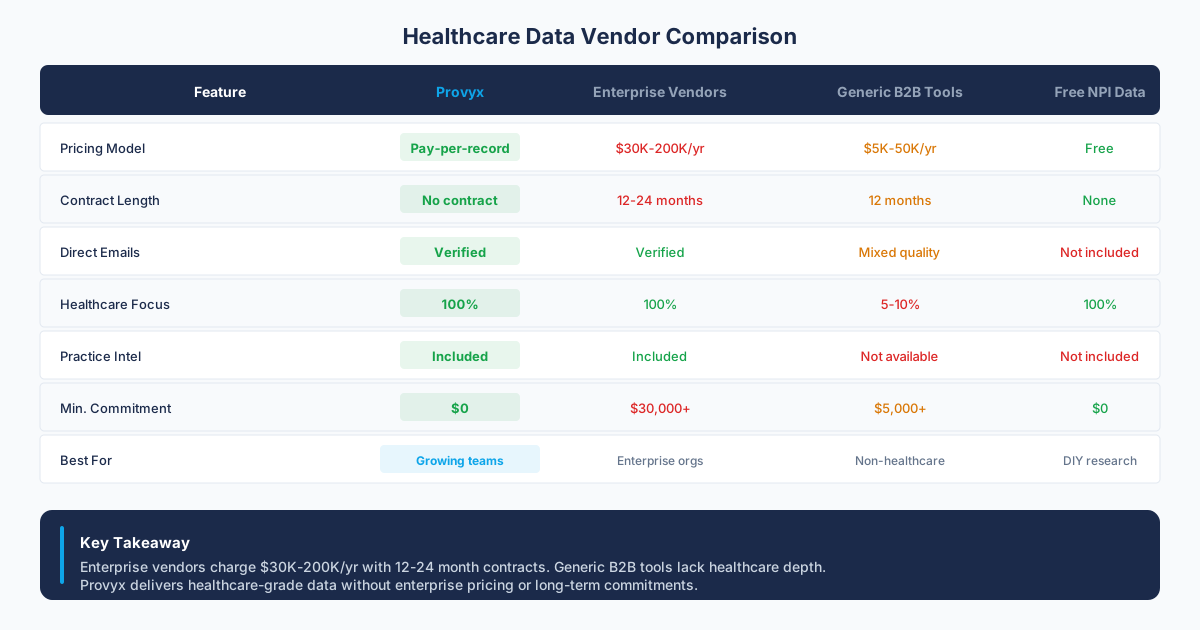
If you're evaluating data sources for a territory project, the healthcare data vendor comparison covers how project-based location builds compare with enterprise platform subscriptions on cost and refresh timing.
What's in a Provyx Practice Location Record?
Geocoded Addresses with Latitude and Longitude
Every practice address is geocoded to rooftop-level precision where possible, with latitude and longitude coordinates included in every record. This allows you to run radius searches, build heat maps, calculate drive-time polygons, and perform spatial analysis without a separate geocoding step. Addresses that can only be geocoded to the zip centroid level are flagged so you know the precision level of each coordinate pair.
Type 1 and Type 2 NPI Classification
We classify every location by its association with Type 1 (individual provider) and Type 2 (organizational) NPI records. This matters because an individual physician might practice at a location registered under a group's Type 2 NPI. Our records link both, so you can see all individual providers associated with an organizational location and all locations associated with an individual provider. This cross-referencing is sourced from NPPES files and supplemented with claims-derived affiliation data.
Multi-Location Mapping with Primary and Secondary Designation
For providers and organizations with multiple practice sites, we map every known location and designate which is the primary site. Secondary sites are listed with their own full address records. This is critical for medical device reps planning routes and for payers validating network directory listings at the site level.
Practice Address vs Mailing Address Differentiation
We maintain separate fields for practice location address and mailing address, and we flag records where these differ. About 40% of NPI records have mismatched addresses. If you're sending physical mail, you need the mailing address. If you're dispatching a field rep, you need the practice address. Conflating the two is one of the most common and costly mistakes in healthcare location data. Our records make the distinction explicit.
Add-ons: Additional location enrichment includes hours of operation, wheelchair accessibility flags, and public transit proximity scores where available from business listing sources.
How Does Provyx Build Practice Location Intelligence?
The foundation is the NPPES data dissemination, which provides the self-reported practice and mailing addresses for every NPI record. We supplement this with commercial business listing databases, Google Places data, and state facility licensing records to validate and enrich each address.
Geocoding is validated through multiple layers to catch common failures like addresses that resolve to the wrong side of the street or to a zip centroid instead of the actual building.
Multi-location mapping draws from organizational NPI records, practice website analysis, and appointment booking platforms. If a practice website lists three office locations, we capture all three and link them to the appropriate NPI records.
Who Uses Practice Location Data
Medical device sales teams use geocoded location data for territory planning and route optimization. Knowing the exact coordinates of every orthopedic practice within a 50-mile radius, along with which are primary vs satellite sites, makes daily route planning far more efficient. See our medical device solutions.
Health plan network teams rely on practice location intelligence for network adequacy reporting. CMS and state regulators require health plans to demonstrate that members have access to providers within specific distance and drive-time thresholds. Accurate geocoded data makes those calculations possible.
Healthcare real estate developers use location data to identify underserved areas and site new facilities. Understanding where existing practices cluster and where gaps exist drives development strategy. Overlaying provider density maps with population data reveals opportunities that spreadsheets alone can't surface.
Healthcare marketers use location data to build geo-targeted campaigns that reach providers in specific zip codes, counties, or MSAs. Visit our health tech page for more.
How Accurate Is the Practice Location Data?
Practice addresses are the most stable field in our database. Providers move less often than they change phone numbers. That said, we still see roughly 8-12% of addresses change annually due to practice relocations, closures, and mergers.
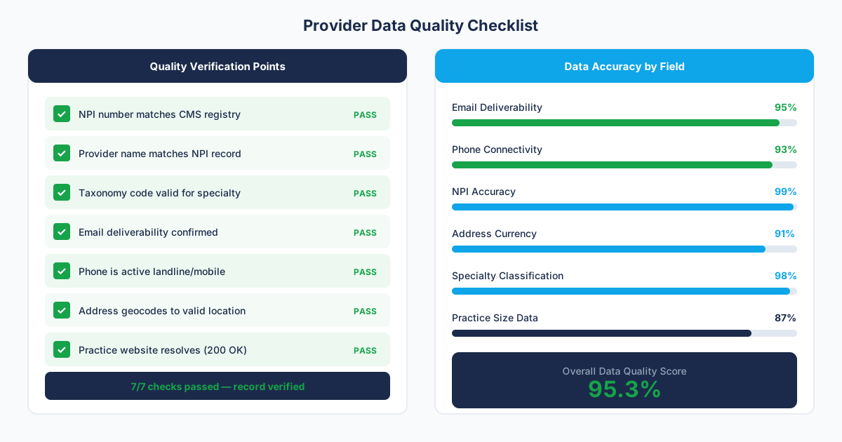
Addresses are standardized and validated to correct formatting issues like misspelled street names, missing suite numbers, and inconsistent abbreviations. We cross-check against business listing databases to confirm that the address corresponds to an active healthcare practice and not a vacant building or unrelated business. Location data is refreshed on demand.
"Territory planning went from a quarterly headache to a straightforward process. Knowing where every provider sees patients, instead of the billing address on file, changed how we allocate reps."
What is Practice Location Data?
Practice Location Data is geocoded address intelligence for healthcare practices, including latitude/longitude coordinates, multi-site mapping, location type classification, and differentiation between patient-facing practice locations and administrative mailing addresses.
Accurate practice location data is critical for territory planning, market sizing, and proximity-based targeting, where knowing a provider's actual clinical site matters more than their NPI mailing address.
How to Get Healthcare Practice Location Data
- Select specialties and regions:: Choose target specialties and define geographic boundaries by state, county, metro area, or radius.
- We geocode and classify locations:: Every address is geocoded with lat/long coordinates and classified as a clinical site, hospital, or administrative office.
- Multi-site practices are mapped:: Providers operating across multiple locations are linked so you can see every site associated with a practice.
- Receive location-enriched records:: Get practice data with verified addresses, coordinates, and location metadata in your preferred format.
Frequently Asked Questions
What's the geocoding precision level?
Most addresses are geocoded to rooftop-level precision, meaning the coordinates point to the specific building. When rooftop geocoding isn't possible, typically for rural addresses or new construction, we fall back to parcel or street-level precision. Every record includes a precision indicator so you know the accuracy level of the coordinates.
How do you handle practices that have closed?
We check NPI deactivation records, business registration status, and web presence signals to identify closed practices. Deactivated NPI records are flagged, and addresses associated with confirmed closures are marked as inactive. We don't remove them from the database because historical location data is valuable for market analysis, but they won't appear in active-only data pulls.
Can I get location data in a GIS-compatible format?
Yes. We deliver location data in CSV with lat/long columns by default, which imports directly into any GIS tool. We can also provide GeoJSON or Shapefile formats on request. If you're integrating with a mapping platform like Mapbox or Google Maps, the default CSV format with WGS84 coordinates works without any conversion.
How many practice locations are in the database?
The database covers over 3.5 million practice location records linked to active NPI registrations across all 50 states and territories. This includes both Type 1 individual provider locations and Type 2 organizational locations. The count fluctuates as new providers enumerate and others deactivate, but we track every active NPI in the NPPES system.
What's the difference between a practice address and a mailing address?
The practice address is where a provider sees patients. The mailing address is where correspondence goes, and for roughly 40% of NPI records it points somewhere else entirely, often a billing company or a PO box in another state. Field reps routed to mailing addresses waste trips. Direct mail sent to practice addresses sits unopened at a front desk. Our records carry both fields with a mismatch flag.
Can I order locations within a radius of a specific point?
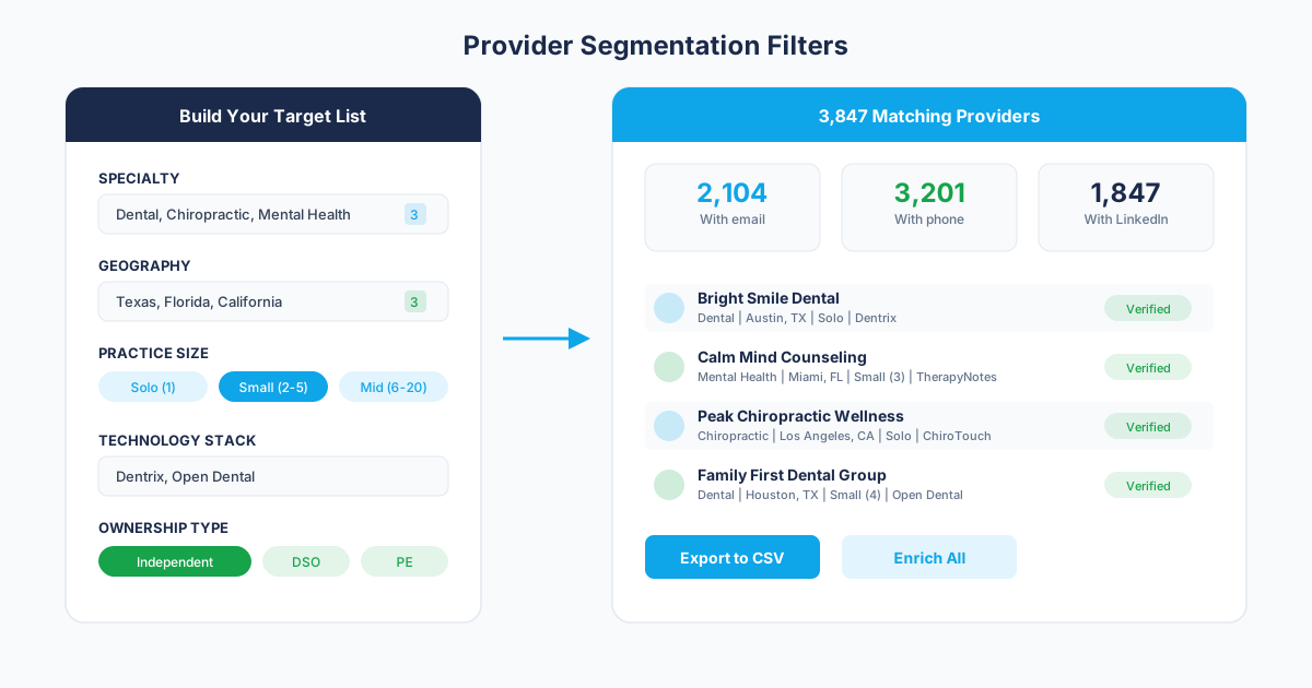
Yes. Radius pulls are a standard scoping option: give us a center point (an address, a zip code, or coordinates) and a distance, and we deliver every matching practice location inside that circle. You can combine radius with specialty and practice-size filters, which is how most device teams scope rep territories around a metro.
Get the Provider Data You Need
Tell us what you're looking for. We'll build a custom list matched to your target market.
Trusted by healthcare sales teams, medical device companies, and health IT vendors across the US.